You are using an out of date browser. It may not display this or other websites correctly.
You should upgrade or use an alternative browser.
You should upgrade or use an alternative browser.
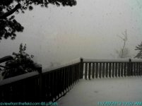
Copper Harbor is getting hammered
- Thread starter Admin
- Start date
D
Deleted member 10829
Guest
Sweet! Must be more of a westerly wind, eh?
packerlandrider
Well-known member
My thought as well. Amazing to look at the Mohawk cam multiple times this morning and see bright, sunny skies.
East wind. Models have been indicating the convergence band hitting them so drift south as we go through the day. I'm hoping, I hoping!
Big meso-low to the north of the Bayfield Peninsula.
Maybe even a meso-low for Big Bay and the basins inland tonight/early tomorrow.
-John
Big meso-low to the north of the Bayfield Peninsula.
Maybe even a meso-low for Big Bay and the basins inland tonight/early tomorrow.
-John
tritonmark
New member
Awesome !! Happy Thanksgiving to everyone
garyl62
Active member
East wind. Models have been indicating the convergence band hitting them so drift south as we go through the day. I'm hoping, I hoping!
Big meso-low to the north of the Bayfield Peninsula.
Maybe even a meso-low for Big Bay and the basins inland tonight/early tomorrow.
-John
Thanks John. Remind me to bump your pay to time and a half for working the holiday!
garyl62
Active member
Holiday pay is double time! LOL.
MI is now right to work state so I figured non-union wages
How about a dollar for every inch that comes down. Are you willing to work piece meal John?
A dollar for each inch all season?
The band is starting to drift south. Lac La Belle getting hit now and cloud bank is getting closer to me. Hope it holds together, maybe even stalls. Would be nice to take a Black Friday powder ride.
-John
East wind. Models have been indicating the convergence band hitting them so drift south as we go through the day. I'm hoping, I hoping!
Big meso-low to the north of the Bayfield Peninsula.
Maybe even a meso-low for Big Bay and the basins inland tonight/early tomorrow.
-John
Is this the setup that creates the legendary "Bayfield Bomber"?
D
Deleted member 10829
Guest
I saw that, awesome!
Mark, i think it is an east wind right now? A mesolow is located to the east of the Kee right now?
I see John answered the question, thanks!
I'm so used to it being more of a west flow. I'm curious how often this happens? That's one thing nice about a peninsula, you can get lake effect from more directions!
highhertel
Member
Maybe the meso low will drift over Detroit, shut down the airport to keep the Packers from coming home.
Otherwise Happy Thanksgiving all!
HH
Otherwise Happy Thanksgiving all!
HH
I was out skiing this morning with the neighbor's yellow lab (dog sitting duties today), and could see the dark blue skies across Bete Grise as the snow band was moving in. After we got back to Lac La Belle, it snowed 8 inches in about 4 hours. I needed snowshoes for our evening walk. Pretty cool. A few years back, an even heavier snow band dropped 24 inches in about 6 hours in Houghton. That time my ski tracks were filling in right behind my skis and I was skiing right behind the groomer at MTU.
Is this the setup that creates the legendary "Bayfield Bomber"?
The Bayfield Bomber is with a WSW flow. When all the conditions are right, it sets up a nice (and usually bigger) convergence band that can hit anywhere from around Toivola north. Has been known to produce 1-2' in just a few hours. We have not seen one in quite some time. I think we are overdue!
I'm so used to it being more of a west flow. I'm curious how often this happens? That's one thing nice about a peninsula, you can get lake effect from more directions!
Pure LES with an east wind is usually pretty rare. Typically when there is an east wind, there is usually a low just to our south and some system snow involved as well, so it is called lake enhanced.
By the way, the band did make it to us by around 2pm, but had weakened considerably. All we got was around an inch. Mohawk and its surrounding suburbs have been the banana belt so far this winter. Was more snow in Lake Linden and Bootjack when I was down there on Wednesday. Not too concerned yet.
-John

