You are using an out of date browser. It may not display this or other websites correctly.
You should upgrade or use an alternative browser.
You should upgrade or use an alternative browser.
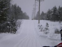
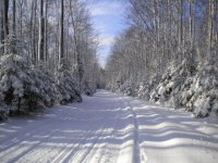
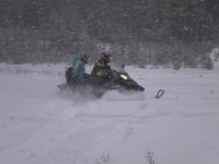
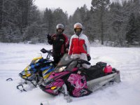
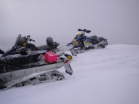
Having some fun in the snow
- Thread starter skidoodragon
- Start date

skidoodragon
New member
sledaholic
Member
pretty colorful wraps on those sleds no mistaking those in the parking lot
skidoodragon
New member
chickenbone76
New member
Great pics.
yamahachick
New member
Awesome pics, love the designs on your sleds.
skidoodragon
New member
Thanks!
skidoodragon
New member
Thanks. Graphics are from ,www.sledwraps.com out of New York.
Last edited:
driftsmasher
New member
the sled wraps look great!
fotoman1261
New member
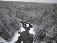
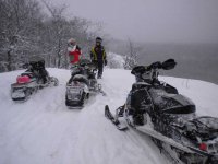
The last picture of that river valley where is that exactly? Do you know if the river stays open all year? Is there easy access by foot? Looking to take some photos of this type of scenery. Don't have access or money to rent a sled. Thank you for your reply and help.
skidoodragon
New member
Reporting from S.C.
If I had a Atlas infront of me I could tell you exactly were it is. I know it's east of Bruces Crossing. Yes you can get there by car I belive.
If I had a Atlas infront of me I could tell you exactly were it is. I know it's east of Bruces Crossing. Yes you can get there by car I belive.
The last picture of that river valley where is that exactly?
If I know it's east of Bruces Crossing. Yes you can get there by car I belive.
If I had to guess I'd say Agate Falls, or perhaps looking upstream (Did I say that?¹ Correction, that would be downstream, i.e. north!) from the sled trail (old railroad bridge) there. (About 7 miles east of Bruce Crossing, 3.5 miles east of Paynesville on hwy M-28)
(¹ I woke up in the middle of the night with a flashback to this post: "Did I say upstream?". As well as I know the neighborhood, I am often plagued by an erroneous mental image of the Middle Branch flowing south through here, and at Bond falls as well. An utterly crazy notion, as of course the Ontonagon River does flow north to empty into Lake Superior at Ontonagon.)
Last edited:
Agate Falls
Corrected previous entry.
See also:
1. Agate Falls.
2. A View From Agate Falls Bridge.
3. Hunt's Guide to MICHIGAN'S UPPER PENINSULA: Agate Falls/Bergland-to-Sidnaw Rail Trail.
4. Hunt's Guide to MICHIGAN'S UPPER PENINSULA: Agate Falls Scenic Site.
5. Hunt's Guide to MICHIGAN'S UPPER PENINSULA: Agate Falls-Middle Branch Ontonagon River.
6. Michigan DNR: Agate Falls Scenic Site.
7. Wikipedia: Agate Falls Scenic Site.
Last edited:
skidoodragon
New member
Thanks frnash.