Keweenaw maps

upoutdoorzman

New member
Can anyone point me where to find maps of Keweenaw CFR/corporate lands or from the likes of Nature Conservancy, etc. who own large tracts of land open to the public? Similar to forest service or state forest maps. I used to work for a large paper company in the U.P. that had maps of their land available at one time so looking for something similar. Or insider tips on where to find some off-trail boondocking opportunities. Can PM me if possible. Visiting my daughter at MTU and bringing the sleds to take her riding and promise to be discreet! Thank you!!!

Rob
 
Last edited:

frnash

Active member
County Plat Books will show land ownership. Usually can buy those at the country clerks office.

I found this source https://www.mappingsolutionsgis.com/houghton-keweenaw-counties-michigan-2018-plat-book/
That's a neat option.
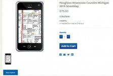
They also offer a digital edition for your smart phone or tablet if you don't want to fumble around with a paper edition:
Plat Maps.jpg
(Click on thumbnail for larger image)

What is a SmartMap?
With the advancement of technology, our plat maps can now easily be viewed interactively on your Android or iOS compatible Smart Phone or Tablet computer. The SmartMap is an electronic version of our newest maps that has been optimized for viewing on your smart phone or tablet. These files are provided in a GeoReferenced Tiff, which can be viewed in Avenza PDF maps. This app is available free for personal use in the Google Play or iTunes App store. Commercial licensing options also available.

These files are great for personal or business use and are commonly used by: Realtors, Bankers, Insurance Agents, Engineers, Farmers, Land Surveyors, Hunters and other recreational use.

Why use a SmartMap?
Ease of use. Just simply pull your phone out and you can view the map with a couple touches of the screen.
Easy to read. Zoom in as close as you need to.
You can customize the SmartMap on your Smartphone
Add your own points of interest
Add photos that are attached to the map
See your GPS location on the county parcel map. Great for seeing who owns property nearby!
Measure distances and areas
Track where you have been - Great for hunters and recreational enthusiasts!

After recording your data, information you have collected can be exported to a KML file for use in Google Earth or other GIS enabled applications!

Great for use while out on a job site. Example: A realtor showing a piece of property to a prospective buyer or a farm manager showing workers which property to spread fertilizer on.
 
Top