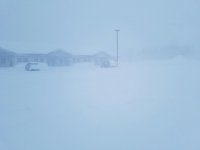
Could you possibly explain what on earth this spinning low is in the middle of Superior? It's been sitting there n radar for over a day and now they're talking about it coming ashore in the same manner you discuss a hurricane. What on earth is this? I can deduce from the term meso low the basic term...but I've never heard of this.
From MQT:
Strong mesolow is located near Michipicoten Island on eastern Lk
Superior and this is expected to surge southwest toward south
central Lk Superior this morning. Heavy snow and very strong winds
are expected. 3 hr pressure rises of at least 10 mb are expected so
enhancement to gradient winds will result in wind gusts of 40-50 mph
from the north to northeast just in wake of the mesolow. Strongest
winds expected at Copper Harbor this morning and around Marquette
very late this morning into early this afternoon. Given the strength
of lake effect over eastern Lk Superior with radar echoes over 15kft
AGL and higher resolution nighttime satellite showing higher cloud
tops, expect very heavy snow to move in with the mesolow. The heavy
snow along with the 1-2 hour period of 40-45 mph wind gusts will
lead to blizzard conditions. Attm, expect the main impact from
blizzard conditions to be over Marquette. Have messaged this in
the latest winter storm warning statement. However, mesolows can
be highly unpredicable and deliver surprises so the exact location
where most severe conditions occur late this morning into early
aftn may very well need to be refined. Due to the snow/wind this
will produce higher impact. This will turn into more of a nowcast
type situation as we progress through the day.

