Mitchpro1125
New member
Afternoon everybody,
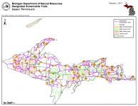
I was hoping one of you incredibly knowledgable UP fans could assist me in hunting down a digital image/ PDF file of the entire UP trail system. I'm finishing up my last year of college and as you could imagine the wallet isn't quite as deep as others. Long story short, I've come up with the idea of wanting to find the entire UP trail system in order to use one of the fancy printers we as students have access to in order to print out a 3' by 5'( normal flag size) "poster" of the UP for a Christmas gift idea. I wanted to laminate it and frame so that trip plans and loop ideas could be talked about and written down with a dry erase marker or something alike right there on the wall. I think my father and uncles would LOVE this addition to the Northwoods cabin basement.
I've looked everywhere online and even contacted a club trying to find a full UP map, but all I can find is maps either broken up by region( western/eastern) or by counties. I'm more than willing to pay for a map like I do each year in order to have such download, but I cannot find a map with the entire UP in one image for the life of me. I was hoping some of you had either had this same idea or are aware of a way for me to obtain a map.
Thanks all,
MP


