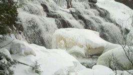
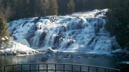
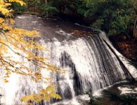
Last Sunday my husband and I went to see Bond Falls. We had no idea this gem was so close, only 35 miles from our cabin in Star Lake WI. A customer of ours told us about it. How did we not know? Don't worry if you have a hard time getting around because it's wheel chair friendly. Go and see it if you haven't. Also went by mrsrunningbears place. Super nice, even saw a few campers in the back.
You are using an out of date browser. It may not display this or other websites correctly.
You should upgrade or use an alternative browser.
You should upgrade or use an alternative browser.
Bond Falls in Paulding
- Thread starter starlaker
- Start date
sweeperguy
Active member
If you think it's nice now, go see it in February.
I've not seen those falls in winter, but I'd agree, because I've seen Thaquamenon Falls in winter are very cool, even Minnehaha creek falls here in the cities is pretty cool in ice season.
If you think it's nice now, go see it in February.
X2!
I've always found Bond Falls to be pretty underwhelming, at least in comparison to "Thaquamenon" (?), er… Tahquamenon Falls ("Michigan's Niagara"). So many falls (200+ in da UP), so little time!
UPTravel.com: "Waterfalls of the U.P."
UPTravel.com: "Waterfalls of the U.P."
Last edited:
onlypolar4me
Member
packerlandrider
Well-known member
I've always found Bond Falls to be pretty underwhelming, at least in comparison to "Thaquamenon" (?), er… Tahquamenon Falls ("Michigan's Niagara"). So many falls (200+ in da UP), so little time!
UPTravel.com: "Waterfalls of the U.P."
For those looking for an even more detailed waterfall map for the U.P. (at least the northern/western areas), visit: http://www.waterfallsofthekeweenaw.com/map/
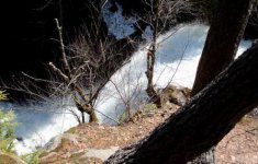
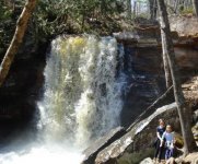
Another favorite UP waterfall that is easily accessible is Hungarian Falls. This is a series of waterfalls on the Keweenaw Fault, each with its own unique character. There are interpretive signs to help visitors to understand the geology of the area. These falls are especially nice in the spring when they are really going off.
Last edited:
Go Fast or Go Home
Active member
Beautiful Brent. Can you get there by sled? frnash now I have to put Tahquamenon falls on my bucket list. Thanks for the tip. Dawn
Yes--You can get to Bond Falls by sled---
You need permission to get in there? Oh yeah, and good luck with that!… Mountain Stream Falls in the Huron Mountain Club is one of my personal favorites in Upper Michigan. I've only been there a few times when I was working in that neck of the woods, and you need permission to get in there.
Likewise for my second favorite UP/Keweenaw waterfall: Douglass Houghton Falls¹, one of the most beautiful falls in the entire UP!
It is located on private property, to the north/east of M-26 between Lake Linden and Laurium, along Hammell Creek, and the property owner has closed it off to the public, largely for reasons of public liability, after a number of doofus' had fallen and had to be rescued. So yes, it's OFF LIMITS!
I was there a few times during my years at "da Tech", also before it was closed off, and hiking in from the bottom, but of course I have no photos.
[¹ Actually that's a misnomer — everyone has called it "Douglass Houghton Falls" for decades, on the presumption that it was named for (click →) Douglass Houghton. Nice idea, seems obvious, but not true.]
Just for the record, as noted in this posting by a PastyCam contibutor on Tuesday, September 23, 2003 - 07:19 pm, the true and historically correct name for the "Douglass Houghton Falls" was in fact correctly and deliberately "Houghton-Douglas Falls"!
"The story is that the Falls were named after both Douglas Houghton and Christopher C. Douglass. C.C. Douglass was a member of Houghton's survey party and stayed in the Keweenaw where he was one of the founders of Houghton and Hancock along with being an officer for many mines. The names were evidently deliberately reversed from alphabetical order to avoid the unfounded conclusion that the falls were named after Douglas Houghton. Once the old sign disappeared in the '60's, the name Douglas Houghton stuck."
For me, what sets Houghton-Douglass Falls (a.k.a. Douglass Houghton Falls) — which are not at all visible just 1000 ft. off the road(!) — apart as both visually and geologically unique is that unlike most waterfalls, descending conspicuously from some relatively high terrain to a valley below, this is as if Paul Bunyan came by and stuck a large round-nosed shovel into the ridge upstream along Hammell Creek, removing a huge shovelful of earth and leaving Hammell Creek to plunge from relatively level ground over the precipice into the resulting cataract, thus forming the falls.
As Paul Harvey would say, "Now you know the rest of the story…".
Although "you can't get there from here", at least we have a few pictures:
1. Courtesy of (click →) Nancy Nelson's shoebox and PastyCam.
2. Courtesy of (click →) Sharon Smith (circa 1981) and PastyCam.
And finally, a tip o' the hat and honorable mention to a pleasant little pair of falls just up the road from the ol' family farm in near Bruce Crossing, and both located about a mile due east of US-45 just north of Burma Road (a bit farther along the trail):
(click →) O Kun De Kun Falls.
… and it's neighbor …
(click →) Peanut Butter Falls.
L
lenny
Guest
I bet I know of a fancy side by side that could make it to the water,,,,, and no,,,, it's not a VikingGoing to see a few falls next week. Sturgeon falls is my favorite. From the south,take FR 2200 from M28 approx 14 miles north.You do have to hike down to it,maybe 10 min.

