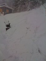
Special Weather Statement from the Keweenaw County Avalanche Center - Allouez Township
March 1, 2012
AVALANCHE WARNING:
A recent storm cycle has deposited over 36" of snow in much of Keweenaw County in the past 10 days. The new snow lies upon a weak layer of snow caused by freeze-thaw cycles earlier in February.
Skier and riders have the ability to trigger hard slab avalanches of up to 3 feet in depth on north and northwest facing slopes. The avalanches have the ability to cause severe damage and death to any person caught in them.
Extreme caution should be exercised when traveling in avalanche country. Travel is not recommended on slopes of greater than 30 degrees and proper route planning should be exercised.
New snows of 3-6" will further destabilize the snowpack starting later Friday and continuing into the weekend.
J. Dee
Lead Avalanche Forecaster
Keweenaw County Avalanche Center
(ok, so maybe I have too much time on my hands this morning, but if we had any hills without trees all over them, this would all be true!)

