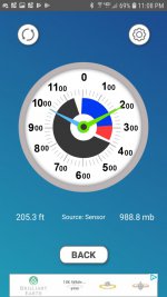
I found a spot higher than mount arvon

T

Tracker

Guest
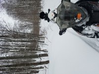
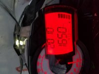
So we were out in the backcountry within 5 miles of Mount arvon and I was exploring every Rabbit Trail I could find and we stopped because it appeared that this area was higher than Mount arvon so I did in altitude reading off of my sled check this out man and it went another 20 feet higher at least.....proof

20190103_173235.jpg

- - - Updated - - -

Was back in here

20190103_162500.jpg

20190103_142330.jpg

20190103_162511.jpg
 

kwikgren

Member
Proves nothing. Just curious what does your altimeter read when you are actually at the summit of Mt. Arvon? What does it read when you are at the summit of Mt. Curwood? What does it read when you are at the summit of Summit Peak in the Porkies? Also, is that the same set of gauges that you use to prove beyond any reasonable doubt your claims that you are tooling along at 90mph all over the freaking place? What does the same sled actually get for speed in a radar run? ...and on and on. Oh yeah what about bigfoot?
 

sweeperguy

Active member
Proves nothing. Just curious what does your altimeter read when you are actually at the summit of Mt. Arvon? What does it read when you are at the summit of Mt. Curwood? What does it read when you are at the summit of Summit Peak in the Porkies? Also, is that the same set of gauges that you use to prove beyond any reasonable doubt your claims that you are tooling along at 90mph all over the freaking place? What does the same sled actually get for speed in a radar run? ...and on and on. Oh yeah what about bigfoot?

Big foot is a groomer driver now.
Screenshot_20190126-162053_Facebook.jpg
 
T

Tracker

Guest
Hahaha....good one....and my speed and altimeter have been checked and double by people I am with on their cell phones...garmins....and altimeters....its off +/- 3 feet....and 2 mph.....and in case you haven't poked yer cockroachish head out from the rock....this Is now the highest spot and even higher with snow....not to mention it's not the only spot higher than 1976 arvin....lol....trolls

https://k1025.com/mount-arvon-is-no-longer-michigans-highest-point-this-pile-of-mining-waste-is/
 
T

Tracker

Guest
Mount Arvon is No Longer Michigan's Highest Point, This Pile of Mining Waste Is. Mount Arvon in northern Michigan's Huron Mountains has always been considered the highest point in the state. Surprisingly, that high point has been replaced by a pile of mining waste from the Tilden Mine near Ishpeming.Jan 28, 2019
 

kwikgren

Member
Hahaha....good one....and my speed and altimeter have been checked and double by people I am with on their cell phones...garmins....and altimeters....its off +/- 3 feet....and 2 mph.....and in case you haven't poked yer cockroachish head out from the rock....this Is now the highest spot and even higher with snow....not to mention it's not the only spot higher than 1976 arvin....lol....trolls

https://k1025.com/mount-arvon-is-no-longer-michigans-highest-point-this-pile-of-mining-waste-is/

https://k1025.com/mount-arvon-is-no-longer-michigans-highest-point-this-pile-of-mining-waste-is/[/QUOTE]

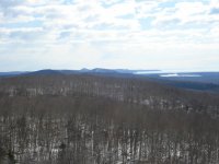
Yes, its been common knowledge for at least 20 years that it was only a matter of time before the Tilden rock pile was going to be higher than 2000' elevation. But your claim was that you found a spot that was within 5 miles of Mt. Arvon on a rabbit trail that was 2010' elevation according to your altimeter, and I'm thinking that is a false reading. It's certainly possible that there are higher points than Mt. Arvon that weren't surveyed but they would have to be very close to Mt. Arvon in elevation or they would be easily seen from across Keweenaw Bay, like the area around Mt. Arvon is. The most visible point in the vicinity is the location of the old Arvon fire tower but that point is actually lower than 1979', and nothing else on those highlands really stands out but 30 feet higher is actually pretty marginal, so if you could please share that exact location, it would be nice to verify that you are not full of it. Sometimes its hard to tell.

I was on Mt. Arvon (doing unrelated work) on the day that the U.S.G.S. surveyor discovered that Mt. Arvon was one foot higher than Mt. Curwood, and he was debating whether or not to even tell anyone about it. It turned out to be big news locally at the time, but the fine print hinted that there were a number of spots over 1900' in elevation so how significant of a discovery is plus or minus a couple of hundred feet any way. This isn't K2 vs. Mt. Everest we are talking about. But there are people who like to visit the highest point in every state and its pretty ironic that such a low elevation as Michigan is hard to pinpoint and such a challenging climb as Denali is easy to find but hard to get to.
 

eao

Active member
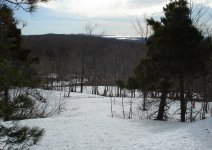
fyi.....................
21015770-1522587411136158-4253946597532055912-o.jpg

MTArvon.jpg

DSC-0020-1.jpg
 

snoluver1

Active member
For what ever it's worth, those Cat gauges aren't exactly a precision instrument. It takes inputs from the ECM to calculate altitude. It needs to be calibrated often to be anywhere close to accurate, and even then, weather conditions effect the readings...

I've been side by side with the same year sleds, both calibrated, with readings more than 75ft different from each other.
 

kwikgren

Member
Yes, that has been my experience also that it is difficult to get accurate elevations with these field instruments. I know the Garmin's I have used in the past, including military grade, have been accurate for gps coordinates but the elevations were not accurate. For my field work, if I needed general elevations I would use the topographic layer and just go with that.
 

kwikgren

Member
So today I rode the mountain bike from my house to the summit of Mt. Horace Greeley, the highest point in Keweenaw County, or is it? One of my buds claimed that at the top at the old radar installation is fill so the elevation has been artificially increased to 1550'. I wanted to take a closer look. From what I could tell there is rock outcrop to within about 14-16' of the summit with some fill on top, so the natural elevation could be as low as 1534' which is about the same as the top of Buffalo Hills, the second highest point. Interesting.

Photos show view of Buffalo Hills and Praiseville Hill from the summit of Mt. Horace Greeley on 4-28-19, my bike on a ride up to Mt. Arvon on 8-22-18, view of Lac La Belle from Mt. Horace Greeley on 4-28-19, evidence of bigfoot or at least a black bear on 5-6-19, and another look at Lac La Belle from the radar base on 5-6-19. No photos from today as was foggy and rain offand on .
 

Attachments

  • 077.jpg
    077.jpg
    264.9 KB · Views: 63
  • 073.jpg
    073.jpg
    208.2 KB · Views: 46
  • 011.jpg
    011.jpg
    146.7 KB · Views: 55
  • 020.jpg
    020.jpg
    287 KB · Views: 58
  • 013.jpg
    013.jpg
    372.4 KB · Views: 63
Last edited:

kwikgren

Member
"Note that the gauge's altimeter is barometric pressure based. Barometric pressure is not only related to altitude, but weather conditions as well, so the gauge may become inaccurate even through the course of a single day."

Tourists with toys.

If you could please share your alleged altimeter readings at points of known elevation and the exact locations that you claim are over 2000', otherwise forget about it.
 

kwikgren

Member
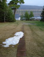
Meanwhile, still a patch of snow in my backyard. It wont make it to June but put up a valiant effort.

- - - Updated - - -

Photographic proof of Bigfoot or at least Littlefoot.

007.JPG
 

Attachments

  • 006.jpg
    006.jpg
    235.6 KB · Views: 23

favoritos

Well-known member
"Note that the gauge's altimeter is barometric pressure based. Barometric pressure is not only related to altitude, but weather conditions as well, so the gauge may become inaccurate even through the course of a single day."

Tourists with toys.

If you could please share your alleged altimeter readings at points of known elevation and the exact locations that you claim are over 2000', otherwise forget about it.

To the bold. We often ride with several machines using the stock and NS1. (They both use the same sending unit for the reading.) I have often calibrated them all at the same time. There is quite a variance throughout the day between readings on the calibrated machines. I honestly consider the readings more of a suggestion of altitude.

The discussion is kinda fun though. I've looked out from Mt. Arvon and wondered. It's interesting how perspective looks compared to the numbers.

I'm kinda waiting for Frnash to chime in about how a real altimeter works. I can't imagine that they 100% accurate even though flying does have a need for accuracy.
 

frnash

Active member
… I'm kinda waiting for Frnash to chime in about how a real altimeter works. I can't imagine that they 100% accurate even though flying does have a need for accuracy.
The traditional aircraft altimeter is also "barometric pressure based". And you'll find the pilot resetting the altimeter quite frequently. The current altimeter setting is reported on ATIS and is included in each approach and landing clearance issued by FAA controllers.

As noted in the FAA's "Airman's Information Manual", Chapter 7. Safety of Flight, Section 2. Altimeter Setting Procedures, quoted here in part:
Procedures

"The cruising altitude or flight level of aircraft must be maintained by reference to an altimeter which must be set, when operating:

"Below 18,000 feet MSL.

"When the barometric pressure is 31.00 inches Hg. or less. To the current reported altimeter setting of a station along the route and within 100 NM of the aircraft, or if there is no station within this area, the current reported altimeter setting of an appropriate available station. When an aircraft is en route on an instrument flight plan, air traffic controllers will furnish this information to the pilot at least once while the aircraft is in the controllers area of jurisdiction. In the case of an aircraft not equipped with a radio, set to the elevation of the departure airport or use an appropriate altimeter setting available prior to departure.

"When the barometric pressure exceeds 31.00 inches Hg. The following procedures will be placed in effect by NOTAM defining the geographic area affected:

"For all aircraft. Set 31.00 inches for en route operations below 18,000 feet MSL. Maintain this setting until beyond the affected area or until reaching final approach segment. At the beginning of the final approach segment, the current altimeter setting will be set, if possible. If not possible, 31.00 inches will remain set throughout the approach. Aircraft on departure or missed approach will set 31.00 inches prior to reaching any mandatory/crossing altitude or 1,500 feet AGL, whichever is lower. (Air traffic control will issue actual altimeter settings and advise pilots to set 31.00 inches in their altimeters for en route operations below 18,000 feet MSL in affected areas.)

"At or above 18,000 feet MSL. To 29.92 inches of mercury (standard setting). The lowest usable flight level is determined by the atmospheric pressure in the area of operation …."
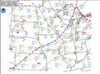
As to flogging around on the ground with a sled, 4x4 or any other vehicle with an altimeter, consider the following Surface Analysis chart for 2019-05-25 @ 1800Z:

WX Chart#1.JPG
(click thumbnail for larger image)

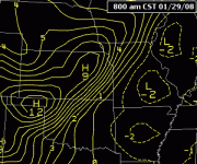
Or this moving GIF image showing the dynamic change in atmospheric pressure with time.
Loop_isallobaric_tendencies.gif
(click image to see the dynamic movement.)

That should give you an idea of the challenge involved in using an altimeter while traveling around in a ground vehicle over time, and the expectation of accuracy in single-digits in feet in the reported altitudes.
 
Last edited:
Top