John nails it again....

Skylar

Super Moderator
Staff member
So, whenever we have a hot summer, people always seem to think that the lake effect will be greater because the lake is so warm, I have even read this in the newset Snowtech magazine. And I have read on numerous times, John's take on this. He has said that by the time the cold weather gets here, the lake has cooled off to normal temps. Well, guess what? It did. LOL.

http://www.crh.noaa.gov/news/display_cmsstory.php?wfo=mqt&storyid=87954&source=0
 

kwikgren

Member
001.jpg

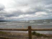
'Tis true. But I thought that was pretty much common knowledge to anybody up here that has a clue. I remember swimming at Picnic rocks in Marquette back in late August 1976, and the water temperature went from the 60's to the 40's F. overnight closing out the beach for swimming for the season. Now this was a warmer summer than most, but still there is lot of cold water out there. As far as the recent storm forecasts went, I have no idea what that NWS guy was talking about, since most of the later forecasts I saw from NWS and TV-6 called for about the amount of snow that fell well inland from the lake. As far as I know, the reason we didn't get more lake effect snow from this particular event is that the gale force winds reduced the fetch across Lake Superior which limits the snow totals and pushes the snow bands farther inland. The winds on Friday October 5 were so strong that there were 20 foot waves at Great Sand Bay, with blowing sand, dry ground, and no precipitation while there was rain and sleet all morning at Lac La Belle.
 

Admin

Administrator
Staff member
What you describe at Picnic Rocks was likely due to upwelling based on the change in winds. This can happen at any beach on Superior at any time things have been warm enough to warm the surface water. I have been at many beaches where lake temps were warm enough to swim in one day and freezing cold the next.

Just to clarify and not toot my own horn, what I talked about was the entire lake surface temps, not just an single locale like a beach.

As for how well the lake cool off by December and thus no effect on lake effect snow production is known, I have actually found it to be a little known fact. If I had a dime for every person (local and non-local) that made a reference to how much snow was going to fall based on warm lake temps in the summer or early autumn, I would be retired. I have even witnessed scientists make reference to this idea. Just read an article in Lake Superior Magazine recently where a reference to the warm lake in summer = big lake effect snows in the winter was made by a scientist.

As for the lack of snow closer to the lake vs. inland, that is not fetch related. A decrease in fetch would impact all areas the same. In this case, it is just the typical early season setup, where areas further inland, but still within the LES zone are not as influenced by the warmer lake temps and thus have more of the precip fall as snow than a rain/snow mix. Thus they get more accumulation. The higher elevations can also help to lead to these areas getting more snow than falls in the lower elevations as the higher elevations can have slightly cooler temps which cause more of the precip to fall as snow, rather than rain/snow mix.

-John
 

ezra

Well-known member
all that has nothing to do with it.
if I buy a new sled no snow
sell a mountain sled non stop snow
keep my old stuff same as last yr
so far outlook not good still holding strong on last yrs sled
 

Admin

Administrator
Staff member
Ezra.

I am pretty sure we could pass the hat and come up with enough of an incentive for you to sell all your sleds. :)

-John
 

kwikgren

Member
View attachment 34482

...the reason we didn't get more lake effect snow from this particular event is that the gale force winds reduced the fetch across Lake Superior which limits the snow totals and pushes the snow bands farther inland...

Please re-read this and give a little consideration to the fact that I am not clueless. The high winds limit the fetch which can reduce the amount of Lake effect (about 0-6" of snow fell across the western U.P.), AND high winds tend to push the snow bands that do fall further inland. Higher elevation is the obvious reason why places like the Huron Mountains and possibly Ironwood got the most snow out of this event (up to about 6" total fell up near Herman) but I'm not sure that it is the only reason judging by the fact that snows were accumulating around Mohawk and Calumet on Saturday morning (the temperature in Calumet was 32F - the same as up at Herman, I know because I was there), but the accumulations were limited because it was blowing so darn hard sweeping the snow bands right off the Keweenaw peninsula and off over Keweenaw Bay over towards Herman. It's not brain surgury, but since Karl's Friday night snow projection map on TV-6 pretty much nailed it, I was impressed.

I remember one early season event a few years back, the lake effect snow bands were pushed well inland and there was about 12-14" of snow cover across the Baraga plains. I wanted to ski, but the heavy, unpacked snow was too deep. I was hoping for some sleds to come by and pack me a trail, but none showed up. So I skied a little bit in the wheel tracks of some die-hard hunters, and then headed down to L'Anse where the snow cover was less and a little more manageable on the skis. I think you, JD, had been up here a year or two already by then, but maybe you were not aware of this event (unless you were trying to keep it a secret, or maybe not jinx it, or whatever other excuse one may use for a blown forcast).
 

Admin

Administrator
Staff member
Sorry you got that from my post, but I am by no means calling you clueless kwikgren.

What I am saying is that the reduction of fetch impacts ALL snow bands and is not selective in nature. Thus all areas downwind that are impacted by the LES snow bands see an equal reduction in snow, rather than some areas seeing more and some being less. LES forms by cold, unstable air traveling over relatively warmer waters. It picks up moisture and heat from the lake and causes the atmosphere to become increasingly unstable, to the point where clouds and precip form. Reducing the amount of time (fetch) that the air remains over the water reduces this process. However, once the air is over land, the process stops, so no enhancement can be done to areas inland, based on fetch.

It is certainly possible that strong winds can blow the banding further inland than is typical in LES regimes with less strong winds and that was likely the case in the event Friday night-Sat. However, the reduction in fetch did not lead to a reduction in snow across one area with an increase in others.

As far as the temps you experienced, I guess I would be interested to know how you were in two different places at one time? To travel from Mohawk to Herman takes approximately 70-80 minutes (if you do the speed limit) and temps at my house did warm from near freezing around daybreak (when we were picking up some accumulating snow) to the mid 30's just an hour or two later, once the solar energy started to kick in. So it is likely that while you measured temps of around 32 in Herman by the time you got there, that was after some warming had taken place and temps were likely in the upper 20's late Fri-early Sat, prior to sunrise, when the snow accumulated in places like Herman.

I agree, Karl did a great job of forecasting the snowfall outlay. His choice of using data from the WRF was a good call. As I have said in the past on this board, Karl is a friend of mine and I think a lot of folks living within his broadcasting reach do not realize how lucky they are to have someone of his talents in such a small market. Not sure what prompted the NWS to issue the advisories for snow as I did not read any of their discussions in that time frame. I certainly do not mean to pick on them as I feel they do a great job in a very difficult area to forecast for too, but there was not a single model that I saw that was calling for the type of snow that would bring about advisories. Most were calling for a sloppy 1/2 to 1" of snow to fall in mainly inland locations not effected by the marine layer, with the tiny bulls-eye of 2-4" in the higher terrain of eastern Baraga County.

-John
 

whitedust

Well-known member
In my experience LES is very fickle some areas are dumped on some not. Elevations, wind direction, temp air & water, instability LES dumps where it dumps. Whenever I hear a LES forecast it is OK let's see what happens if anything? lol:)
 

kwikgren

Member
Yeah JD, I agree the dreaded "marine layer" was probably the biggest reason this minor snow event played out the way it did. But my observations on Friday led me to believe that the high wind was also going to play a role. I'm guessing that it took me a little under an hour to get from Calumet to (up the hill from) L'Anse. There were some semi-treacherous stretches South of Calumet near the airport and along the fields South of Chassell, where the high winds were blowing snow over the highway faster than it could melt, so maybe the minor snow advisory was not entirely inappropriate. I was surprised that the temperature was 32F at a point 10miles SE of L'Anse at an elevation of 1700-1800', I thought it would be a little colder than Calumet up there, but it probably stayed colder for a longer duration up there. Btw, I have been advised not to use the "H" word on this site, adding to the list of places that are now "secret". I'm afraid "most of the cats are now out of their bags", so hopefully, if people can be courteous, tread lightly, and respect private property everybody can get along.
 
Top