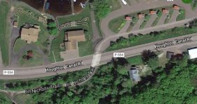
Its considerably more than a few hundreds yards, approx. 1.4 miles, 4 lanes of traffic, no shoulders, heavy traffic. Daily traffic 10,001-20,000 vehicles daily (source MDOT 2017 annual traffic volumes map) …
Just one problem: Your map
DOES NOT show the ATV route so clearly described by
goingnorth!
Lest anyone find that misleading, the ATV Route is shown below:
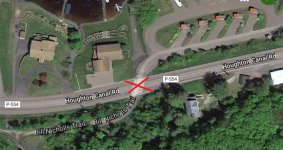 (Click thumbnail for larger image)
Begin at the intersection of the Bill Nicholls Trail and the Houghton Canal Road.
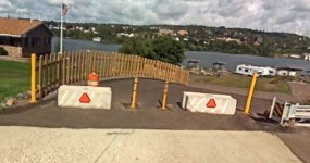 (Click thumbnail for larger image)
Note the traffic barrier at the entry to the RV Park.
The officers will open the gate and allow you to go through the RV Park.
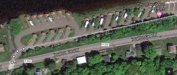 (Click thumbnail for larger image)
Then proceed through the RV Park …
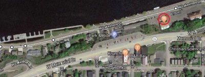 (Click thumbnail for larger image)
Continue along W. Lakeshore Drive, past Roy's Pasties & Bakery …
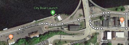 (Click thumbnail for larger image)
Continue along W. Lakeshore Drive and under the bridge to the back of the Ambassador at Quincy St. where "Officers will activate the overhead lights and block off the north/right lane of Shelden Avenue and allow the four wheelers to enter the road and then fall in behind the four wheelers."
When the PD has done their thing, proceed up Quincy Street, and along the right lane of Shelden Avenue then through that crazy traffic pretzel at the south end of the bridge and across, as directed by the PD.
Your "guided tour" will turn right onto M-26 at the north end of the bridge and proceed east to terminate across from The Miners State Bank, at Lake Front Road, with direct access to the Hancock-Lake Linden Trail.
(Mileage: ≈1.05 miles from the gate at the RV park to the "traffic pretzel" at the south end of the bridge, and ≈1.5 miles in all.)


