Snowies, Winter Storm Watch posted

Skylar

Super Moderator
Staff member
...winter storm watch in effect from tuesday afternoon through
wednesday afternoon...

The national weather service in cheyenne has issued a winter
storm watch...which is in effect from tuesday afternoon through
wednesday afternoon.

* timing...late tuesday afternoon through wednesday afternoon.

* total snow accumulations...18 to 24 inches are possible in the
snowy range...with 15 to 20 inches over the southern laramie
range between cheyenne and laramie. Over lower elevations...such
as cheyenne and laramie...8 to 12 inches are possible. Finally
in the southern panhandle from sidney to kimball...5 to 8 inches
are possible wednesday morning through the afternoon.
 

RevKev

New member
...winter storm watch in effect from tuesday afternoon through
wednesday afternoon...

The national weather service in cheyenne has issued a winter
storm watch...which is in effect from tuesday afternoon through
wednesday afternoon.

* timing...late tuesday afternoon through wednesday afternoon.

* total snow accumulations...18 to 24 inches are possible in the
snowy range...with 15 to 20 inches over the southern laramie
range between cheyenne and laramie. Over lower elevations...such
as cheyenne and laramie...8 to 12 inches are possible. Finally
in the southern panhandle from sidney to kimball...5 to 8 inches
are possible wednesday morning through the afternoon.

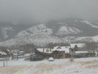
Me likey:p
 

jmom800x

New member
Let it snow, let it snow, let it snow.....we will be loading up the slimo to ride the area December 10th-16th with 15 heads and sleds, so far....
 

lookin4snow

New member
French Creek Snotel shows 14 inches at French Creek. My gauge for the last 4 years out there for early season riding is 40 inches on the Snotel at French Creek and you are good to ride most anywhere. Let it snow!
 

lookin4snow

New member
Here is the updated forecast. Looks like more snow and wind for the Snowies. Base building time.

* TIMING...LIGHT SNOW WILL DEVELOP TUESDAY AFTERNOON AS A STRONG
COLD FRONT MOVES SOUTH ACROSS THE AREA. SNOWFALL MAY BECOME
HEAVY AT TIMES TUESDAY EVENING AND TUESDAY NIGHT BEFORE TAPERING
TO LIGHT SNOW SHOWERS EARLY WEDNESDAY MORNING.

* TOTAL SNOW ACCUMULATIONS...TOTAL SNOW ACCUMULATIONS WILL RANGE
FROM 4 TO 8 INCHES ACROSS THE LOWER ELEVATIONS BELOW 7500
FEET...WITH 10 TO 18 INCHES OF SNOW ACROSS THE SOUTHERN LARAMIE
RANGE...SNOWY RANGE...AND SIERRA MADRE RANGE.

* WINDS/VISIBILITIES...NORTH TO NORTHEAST WINDS WILL INCREASE TO
20 TO 25 MPH WITH GUSTS UP TO 40 MPH POSSIBLE TUESDAY NIGHT.
THESE WINDS WILL CREATE AREAS OF BLOWING AND DRIFTING SNOW
REDUCING VISIBILITIES TO ONE QUARTER OF A MILE AT TIMES.
 

lookin4snow

New member
Well, here comes some more. And imagine that, the snow is coming with high winds....

I know that many of you find the Snowies to be the K-mart or Wal-mart of riding, and it probably is. I much prefer Tog. But, I can tell you that two of my top 5 best powder riding days ever have been in the Snowies. I have spent a lot of time navigating cross-country out there and for the most part you need to be west of Quely to get to the good stuff, IMO.

THE SNOW WILL SPREAD OVER SOUTHEAST WYOMING LATE TONIGHT THROUGH
MIDDAY SATURDAY. ALTHOUGH MOST LOCATIONS WILL RECEIVE A PERIOD
OF LIGHT SNOW...ACCUMULATING SNOW CAN BE EXPECTED OVER AND WEST
OF THE LARAMIE RANGE. THE LARGEST AMOUNTS WILL BE 6 TO 10 INCHES
OVER THE SNOWY AND SIERRA MADRE RANGES. THE REMAINDER OF THAT
AREA WILL SEE BETWEEN 1 AND 3 INCHES OF NEW SNOW.

ALONG WITH THE SNOW WILL BE WEST TO NORTHWEST WINDS GUSTING AS
HIGH AS 55 MPH SATURDAY AFTERNOON AND EARLY SATURDAY NIGHT. THE
STRONG WINDS WILL PRODUCE BLOWING AND DRIFTING SNOW...ESPECIALLY
OVER THE MOUNTAINS AND COLD WIND CHILL VALUES.
 

polarisrider1

New member
Well, here comes some more. And imagine that, the snow is coming with high winds....

I know that many of you find the Snowies to be the K-mart or Wal-mart of riding, and it probably is. I much prefer Tog. But, I can tell you that two of my top 5 best powder riding days ever have been in the Snowies. I have spent a lot of time navigating cross-country out there and for the most part you need to be west of Quely to get to the good stuff, IMO.

THE SNOW WILL SPREAD OVER SOUTHEAST WYOMING LATE TONIGHT THROUGH
MIDDAY SATURDAY. ALTHOUGH MOST LOCATIONS WILL RECEIVE A PERIOD
OF LIGHT SNOW...ACCUMULATING SNOW CAN BE EXPECTED OVER AND WEST
OF THE LARAMIE RANGE. THE LARGEST AMOUNTS WILL BE 6 TO 10 INCHES
OVER THE SNOWY AND SIERRA MADRE RANGES. THE REMAINDER OF THAT
AREA WILL SEE BETWEEN 1 AND 3 INCHES OF NEW SNOW.

ALONG WITH THE SNOW WILL BE WEST TO NORTHWEST WINDS GUSTING AS
HIGH AS 55 MPH SATURDAY AFTERNOON AND EARLY SATURDAY NIGHT. THE
STRONG WINDS WILL PRODUCE BLOWING AND DRIFTING SNOW...ESPECIALLY
OVER THE MOUNTAINS AND COLD WIND CHILL VALUES.
things like this concern me, http://www.tripadvisor.com/Hotel_Re...-Snowy_Mountain_Lodge-Centennial_Wyoming.html
 

polarisrider1

New member
Well, here comes some more. And imagine that, the snow is coming with high winds....

I know that many of you find the Snowies to be the K-mart or Wal-mart of riding, and it probably is. I much prefer Tog. But, I can tell you that two of my top 5 best powder riding days ever have been in the Snowies. I have spent a lot of time navigating cross-country out there and for the most part you need to be west of Quely to get to the good stuff, IMO.

THE SNOW WILL SPREAD OVER SOUTHEAST WYOMING LATE TONIGHT THROUGH
MIDDAY SATURDAY. ALTHOUGH MOST LOCATIONS WILL RECEIVE A PERIOD
OF LIGHT SNOW...ACCUMULATING SNOW CAN BE EXPECTED OVER AND WEST
OF THE LARAMIE RANGE. THE LARGEST AMOUNTS WILL BE 6 TO 10 INCHES
OVER THE SNOWY AND SIERRA MADRE RANGES. THE REMAINDER OF THAT
AREA WILL SEE BETWEEN 1 AND 3 INCHES OF NEW SNOW.

ALONG WITH THE SNOW WILL BE WEST TO NORTHWEST WINDS GUSTING AS
HIGH AS 55 MPH SATURDAY AFTERNOON AND EARLY SATURDAY NIGHT. THE
STRONG WINDS WILL PRODUCE BLOWING AND DRIFTING SNOW...ESPECIALLY
OVER THE MOUNTAINS AND COLD WIND CHILL VALUES.
I suspect you are referring to the Quealy warming hut? and not Quealy Wyoming? I have only ventured about a mile west of the warming hut and things were looking better already, still not Cooke, Tog or IP but better.
 

lookin4snow

New member
PR1, I agree. They needed to get out of there. We do one of two things when we go to the Snowies - we either stay at the Old Corral or we stay at Two Dog Chalet (http://www.vrbo.com/170465). It is a pain to load/unload at Green Rock everyday, but it really isn't that far. Bear Tree pizza is great in Centennial, but beyond that there is not much in the way of food choices. I still like going there once a year.
 

Skylar

Super Moderator
Staff member
It continues....

WYZ112-114-132300-
/O.CON.KCYS.WS.W.0015.000000T0000Z-111114T0700Z/
SIERRA MADRE RANGE-SNOWY RANGE-
INCLUDING THE CITIES OF...CENTENNIAL...ALBANY...WOODS LANDING
358 AM MST SUN NOV 13 2011

...WINTER STORM WARNING REMAINS IN EFFECT UNTIL MIDNIGHT MST
TONIGHT...

A WINTER STORM WARNING REMAINS IN EFFECT UNTIL MIDNIGHT MST
TONIGHT.

* TOTAL SNOW ACCUMULATIONS...SNOW ACCUMULATIONS OF 12 TO 24 INCHES
ARE EXPECTED THROUGH SUNDAY EVENING. THE HIGHEST AMOUNTS WILL BE
OVER THE SIERRA MADRE RANGE AND ALONG WEST AND NORTHWEST FACING
SLOPES.
 
Hey guys, this it the Snowy Mountain Lodge, located 7 miles above Centennial.

Just wanted to update everyone on the snow conditions. Last night (Thursday) we received 3-4 inches of powder, and they're calling for more this weekend starting Saturday evening. We have kicked around the idea of installing a webcam up at our Lodge, anyone have any suggestions for a good one that won't break the bank and won't totally kill the internet (we're on dial-up for now)? Would it be helpful to you guys?

In case you haven't heard, the Lodge is under new ownership (as of October) and will be open in just under 2 weeks. Check us out at snowymountainlodge.com to see what we're doing.
 

snoluver1

Active member
Hey guys, this it the Snowy Mountain Lodge, located 7 miles above Centennial.

Just wanted to update everyone on the snow conditions. Last night (Thursday) we received 3-4 inches of powder, and they're calling for more this weekend starting Saturday evening. We have kicked around the idea of installing a webcam up at our Lodge, anyone have any suggestions for a good one that won't break the bank and won't totally kill the internet (we're on dial-up for now)? Would it be helpful to you guys?

In case you haven't heard, the Lodge is under new ownership (as of October) and will be open in just under 2 weeks. Check us out at snowymountainlodge.com to see what we're doing.

Forget the web cam. WE NEED GAS!...and a beer and a burger at the end of the day wouldn't hurt either. :)
 
We'd love to get gas up there, but the old tank didn't meet EPA standards and had to go. The last two months have been spent fixing all of the damage the snow did to the Lodge and cabins while they sat abandoned for a year and there was just no way to get a new tank up there this year. Sorry guys, but it won't be up there this year.

We have received mixed feedback about the need for putting it up there as many have said they prefer to haul their own in, what do you think?
 
Top