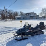
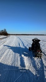
Waushara County

JimAndros

Active member
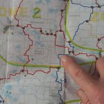
Got out yesterday & did a 32 mile loop. Basically. I jumped on where I'm pointing to & rode Clockwise, turning right at intersections 59, 61, 39 then left on the dead end at 43 to The Ding (green dot 37) then back to 43, right on 43B & 56 home. Some had been dragged, some drifted but overall a good ride. Total, passed 3 other sleds (1 pair twice).
Planning to ride again tomorrow thru Sat. Hopefully E/SE to Poygan, Borth & Eureka one day. Briggsville in SW Marquette another.
 

Attachments

  • 20240115_115657.jpg
    20240115_115657.jpg
    1.4 MB · Views: 44
  • 20240114_123104.jpg
    20240114_123104.jpg
    2.3 MB · Views: 41

SledTL

Active member
Got out yesterday & did a 32 mile loop. Basically. I jumped on where I'm pointing to & rode Clockwise, turning right at intersections 59, 61, 39 then left on the dead end at 43 to The Ding (green dot 37) then back to 43, right on 43B & 56 home. Some had been dragged, some drifted but overall a good ride. Total, passed 3 other sleds (1 pair twice).
Planning to ride again tomorrow thru Sat. Hopefully E/SE to Poygan, Borth & Eureka one day. Briggsville in SW Marquette another.
How are things over in Juneau county? Similar snow depths? Coming to New Lisbon this weekend and looking for good 100+ mile routes from Americinn right off 94 if you know any.
 

JimAndros

Active member
I don't know about west of the river. This is my 3rd winter here, 1st was a bust, last year poor.

That being said, I've been coming to this area over 50 years in the summer. So now I'm exploring via snowmobile.
 

SledTL

Active member
I don't know about west of the river. This is my 3rd winter here, 1st was a bust, last year poor.

That being said, I've been coming to this area over 50 years in the summer. So now I'm exploring via snowmobile.
Yea seems like the river really divides the trails up. We are going to aim to ride southwest towards Sauk county area based on what I've been seeing.
 

JimAndros

Active member
Today I headed east, passing by Pine River & Poy Sippi just to the south. Overall, trails were Good with a periodic Fair until just east of Poy Sippi cemetery. At this point, the trails leave the woods & hills and become farm fields & swamp. From the cemetary east to Borth, I'd have to say Fair with a periodic Good.
From Borth east you enter Winnebago County and trails were Good, groomed double wide thru the frozen Poygan Marsh area just north & east of Haase Supper Club. Headed to The Hill Tavern (Omro address). Returned home taking a southerly route from Borth to Hwy 21 then west past Hwy 49 (where the trails improved) before turning north and eventually getting back into woods & hills before doubling back on the last leg west. Total 56 miles & saw 1 sled.
 

Attachments

  • 20240116_125253.jpg
    20240116_125253.jpg
    1.5 MB · Views: 27

wisco-mb

Active member
Briggsville in SW Marquette another.
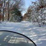
You'll be around my area. We rode them on Monday. Nothing groomed, but plenty of good snow and trails!
Northern Columbia county was groomed. That is a nice section of wooded areas.
Back to work today. but racked up 350 miles of local riding the last couple days.
 

JimAndros

Active member
Today's venture was to Briggsville:
Jumped on the trail at the same point as day 1 (see map in 1st post) south to intersection 59 then west to 63 south, 14 west, 16 south, 22A west, 23 south into Marquette County. Up to this point, trails were Good. After a mile or 2 into Marquette, things went to Poor. Plenty of snow, never groomed or dragged. Path was one sled wide and horrible rough. Also about 2 miles of road route along 2nd Ln. Finally at intersection 1 (west of Westfield) trail was good again until Hwy 82. From there south to intersection 25, Fair to Good. The "muck" farms west of Buffalo Lake were impressive but the drainage ditches & scrappy trees along them were ugly. 25 to Briggsville mostly good. 84 miles, 4 hours.

Lunch at Foxy's was a Patty Melt & fries, very good.

I began the return trip doubling back to Westfield then east under I-39 on corridor 30 East to intersection 3 North to Richford then 22 West to 22A North and doubling back the remainder of the trip. Interestingly, 84 miles & 4 hours back.
 

wisco-mb

Active member
Glad you got some miles on!
Westfield down to Endeavor has some good twisty trails. Watch those drainage ditches. I've seen people put their sleds in there..:oops:
Foxy's always has good food. We've had various county meetings at the bar, and a good supporter of the clubs.
Took a pic around the drainage ditch at the muck farm just south of D on Monday.
Endeavor has a nice warming shack right at the Briggsville split.
 

Attachments

  • Snapchat-474441236.jpg
    Snapchat-474441236.jpg
    1.1 MB · Views: 26

JimAndros

Active member
There were 2 old guys in a Tucker (without the drag in tow) putting up a hand painted sign pointing to the warming shelter at a road crossing about a mile or 2 east of the big Neenah Creek bridge.
They told be they would be out grooming Thursday.
Also, I saw a poster at Foxy's. Didn't pay too much attention but I think it said something about an event at shelter tomorrow?
 

wisco-mb

Active member
Nice. That was the Endeavor crew(Dan, Bill, or John).
Yes, they are putting on a Chili dump at the warming shack starting at 11am. Everyone's welcome!
 

JimAndros

Active member
Chili dump, that's right.
They said they had a 3rd by the bridge checking it out. As I continued west I passed him heading east on an older sled if I recall correctly. So I guess all 3 were out tinkering.
 

JimAndros

Active member
Yesterday, rode to Orihula for lunch at Wolf River Lodge. Snow gets a but thinner to the NE. Still basically Good with some Fair. Thru Pine River going and Saxeville returning. 66 miles RT.

Today, headed east passing Pine River & Poy Sippi to the south to Borth then south to Eureka Landing for lunch. From Eureka south to the Rail grade & west to Berlin. Leaving Berlin to the west then north towards Redgranite, forking east towards Auroraville then turning north thru Fargoville (basically 1 house, a historical marker and a bridge over the Willow Creek). North towards Poy Sippi and back west. Trails were basically good with some thin areas on the fields east if 49. 67 miles RT.
 
Top