You are using an out of date browser. It may not display this or other websites correctly.
You should upgrade or use an alternative browser.
You should upgrade or use an alternative browser.
West Yellowstone
- Thread starter fireworks
- Start date
polarisrider1
New member
Where you staying?
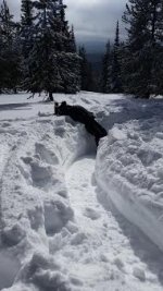
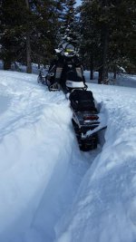
Have rode the last 2 days. Not much for new snow. Received 3-6 inches Sunday night. If you look hard enough there is good snow to be found. We were in some north facing trees that had some good snow. Once you gave it some throttle you would break through hard layer and have a foot and half of soft snow. Was up by Two Top today in the trees and heavy freezing fog set in. That was scary. Thank god I saw it coming and we were almost back to trail before visibility was down to 3-5 feet.
Last edited:
Snow is set up. We are still finding some good snow in the trees thanks to Google earth and my Montana 600. But the temps starting Monday look to be in the low 40's for daytime highs. Perfect temps if trail riding with the wife and enjoying the views. If it's a guys trip and looking to bust powder. Personally, I would look elsewhere. From Tog down to Alpine the received 10-16" last Saturday but then it got warmer than predicted and rained up 7,500' on Sunday. From what I hear the best snow to be found is west of Tog in the Mosquito Creek area. Either way, the wife and I are having a blast. Hardly anyone here this week. Remember, Snowest is having it's big throw down on the 30th. Brandy at the Polaris dealer says that you will be able to see a sneak peak of the 16 Pro.
Attachments
polarisrider1
New member
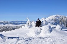
Here is what you will find in the trees if you go looking.
So are you liking the Montana 600?
Second year using it. I have 24 topo and sled gps for trails that overlay easy. When I load tracks back to mapsource I can view in Google earth. That way I can see snow pockets I didn't find and make new routes to the honey holes. I save the paths made in Google as a kml file and convert back to gpx and load to garmin. Only thing that gets on my nerves is sometimes when I touch the screen with glove on the way point window pops up and I have to close it.
polarisrider1
New member
Second year using it. I have 24 topo and sled gps for trails that overlay easy. When I load tracks back to mapsource I can view in Google earth. That way I can see snow pockets I didn't find and make new routes to the honey holes. I save the paths made in Google as a kml file and convert back to gpx and load to garmin. Only thing that gets on my nerves is sometimes when I touch the screen with glove on the way point window pops up and I have to close it.
Wow. I just getting the basics down On it. Can you get each days track to be different colors. That way one can keep separate. Do you run with all the maps on at the same time?
If you receive tracks from device onto mapsource. You will mouse over track. Click on current track, another menu will appear and go to bottom and click track properties. Another screen will appear where you can change color and track name and date. If you create a route. Mouse over route. Click route and then menu will appear and click route properties. Routes/Paths created in Google Earth you can easily choose your color as well. It helps making folders on the desktop for different states or riding areas to keep it organized.
The maps I run all the time are topo wherever we are and then sledgps for trails. Then as we go down the trail to our play area. I pull up route planner and select just that path created in google earth for that spot. You load those gpx files into the gpx directory on garmin. When I have more than a couple paths we want to hit. I text them to myself in the order we want to explore. Or write them down on a cheat sheet.
The maps I run all the time are topo wherever we are and then sledgps for trails. Then as we go down the trail to our play area. I pull up route planner and select just that path created in google earth for that spot. You load those gpx files into the gpx directory on garmin. When I have more than a couple paths we want to hit. I text them to myself in the order we want to explore. Or write them down on a cheat sheet.
We fly out Friday. Cancelled Flying J reservations in Alpine as of now and watching the storm. Kinda hoping West get's more than predicted. We have a 2 bedroom condo available to us in West. Otherwise, if we chase the snow we will end up staying somewhere close to Tog or Lava. Will update post.
A bud is in Island Park now. He said it was terrible as of Sunday, but it had started to snow Sunday. I haven't heard anything since. I'll txt him tonight and see what's going on.
They didn't find any good snow on north facing slopes in the trees? Did they ride Mt. Jefferson west across the flats or East towards Two Top?
polarisrider1
New member
They didn't find any good snow on north facing slopes in the trees? Did they ride Mt. Jefferson west across the flats or East towards Two Top?
Last I heard that Mt. Jefferson has been closed to sleds as of this year. Is there any truth to this?
At the airport. Still haven't decided where we r going yet. West of Idaho falls in ketchum sun valley ski resort area in storm warning 10-30 inches predicted. Cancelled alpine plans. Rain . Togwotee did get snow but not sure. West Yellowstone upper elevation is 17 inches over next 2 days. But rain. The rain line us high at 7500 feet for everywhere. Anybody know of any other storm warnings.