You are using an out of date browser. It may not display this or other websites correctly.
You should upgrade or use an alternative browser.
You should upgrade or use an alternative browser.
#3 trail
- Thread starter Pencefab
- Start date
Okay, I got the official U.S. Dept of Agriculture, U.S. Forest Service, Ottawa Natl. Forest map (hard copy) out, and in front of me as I post this. Absolutely no part of the Bill Nichols trail is inside, or on, any part of the boundaries of the Ottawa Natl. Forest. 0, none, nada!!!!!!!!!!!!!!!!! However, the BN trail does pass thru the Copper Country, and Mishwabic State Forests.
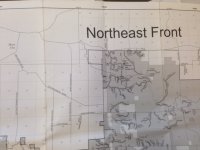
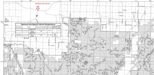
the end of the BN AND THE FIRESTEEL are in that area...its called the northeast section and the northwest front section....is this the Ottawa forest or not....guess MI DNR is wrong according to you too eh?
https://www.fs.usda.gov/Internet/FSE_MEDIA/fseprd538159.jpg
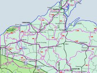
The BN ends in Mass City, which is northeast of Rockland, and not in the Ottawa. It is getting very close to the Ottawa, but not in it. However, you didn't initially only argue that it was in the Ottawa. You claimed that it was in the "yellow" area of the Ottawa map (where boondocking is not allowed after March 1), which is far south of there (south of M28). Rather than doubling down on your mistake, why don't you just look at the info we posted, and admit that you were wrong? It's not even debatable. Look at the damn map I posted.
Your exact words: "just so you know....that's the same yellow area in the restricted thread...Ottawa national forest"
- - - Updated - - -
some people are IN THE KNOW...and some aren't
http://forum.johndee.com/vbulletin/...naw-still-open-for-riding&p=464599#post464599
View attachment 58617
You actually think that thread somehow helps your argument? That thread is about riding from Calumet north, which is north of the Bill Nichols trail, and far north of the Ottawa NF. The BN trail runs from Mass City to Houghton. Calumet is north of Houghton.
Serious question: do you get lost a lot? Because it seems like your map reading and navigational skills are really, really poor.
DamageInc — It's futile, with some folks you can "Buy 'em books, and buy 'em books, and all they do is eat the covers."… Rather than doubling down on your mistake, why don't you just look at the info we posted, and admit that you were wrong? It's not even debatable. Look at the damn map I posted. …

the end of the BN AND THE FIRESTEEL are in that area...its called the northeast section and the northwest front section....is this the Ottawa forest or not....guess MI DNR is wrong according to you too eh?
https://www.fs.usda.gov/Internet/FSE_MEDIA/fseprd538159.jpg
Are you looking at the squares on that map, or the grey area? The square is showing what land is included on the detailed individual maps, and includes land that is not part of the ONF. The grey area is the actual NF land. If you look at those detailed maps, you will see that there are also many islands of privately owned land within the ONF, and that the NF ends by Rockland...which is south of Mass City, where the BN ends.
- - - Updated - - -
DamageInc — It's futile, with some folks you can "Buy 'em books, and buy 'em books, and all they do is eat the covers."
You're right, I give up.
This is my back yard , trail 3 never goes in the gray area
Just to clarify that a bit...Trail 3 does run through the Ottawa south of Rockland. But that section is not the Bill Nichols trail, which only runs from Greenland/Mass City up to Houghton. I suspect that might be part of Tracker's confusion. He might think that all of trail 3 is the Bill Nichols, when it's only one section of it.
tealracing16
Member
Just to clarify that a bit...Trail 3 does run through the Ottawa south of Rockland. But that section is not the Bill Nichols trail, which only runs from Greenland/Mass City up to Houghton. I suspect that might be part of Tracker's confusion. He might think that all of trail 3 is the Bill Nichols, when it's only one section of it.
Whoa did you just give Tracker some leeway?? Better not let him see this! The thread is confusing to me because the title is trail 3 but then he asks about the Bill Nichols trail.
Tracker is probably on his 10th bowl of popcorn by now.
He's on "something" alright!!! It's not popcorn. I think he is more so "out" of it. Post #14 is probably on to i his thoughts, The Pioneer trail. Like I said, he's out of it.
Whoa did you just give Tracker some leeway?? Better not let him see this! The thread is confusing to me because the title is trail 3 but then he asks about the Bill Nichols trail.
Nah, he would still be wrong. I'm just throwing out a possible explanation for his confusion. I'm still not sure how it could be confusing, unless the person has never ridden the BN trail. It has Bill Nichols signs right on the trail. The southern parts of trail 3 do not have those signs.
sweeperguy
Active member
Ol tracker there quick to say I'm a little slow. On his very vague post about oil, and the Analysis on oil ran In a Car.
http://forum.johndee.com/vbulletin/showthread.php?55216-Uh-OH-New-Oil #12
Yet when all this info has been spoon fed to him about the section of trail 3 that is the Bill Nichols trail, he doesn't get it.
Guess I'd be wondering who is actually slow!
My money is on tracker being slow.
http://forum.johndee.com/vbulletin/showthread.php?55216-Uh-OH-New-Oil #12
Yet when all this info has been spoon fed to him about the section of trail 3 that is the Bill Nichols trail, he doesn't get it.
Guess I'd be wondering who is actually slow!
My money is on tracker being slow.
mezz
Well-known member
Ol tracker there quick to say I'm a little slow. On his very vague post about oil, and the Analysis on oil ran In a Car.
http://forum.johndee.com/vbulletin/showthread.php?55216-Uh-OH-New-Oil #12
Yet when all this info has been spoon fed to him about the section of trail 3 that is the Bill Nichols trail, he doesn't get it.
Guess I'd be wondering who is actually slow!
My money is on tracker being slow.
Oh no, say it ain't so!!!

 -Mezz
-Mezzsnobuilder
Well-known member
so what is the history behind the bill nichols trail namesake?
so what is the history behind the bill nichols trail namesake?
snobuilder I thought someone in the know of the "Bill Nichols" namesake for this trail would have responded by now. No dice??? Okay, Bill Nichols, as I have been told many, many, years back now, worked for the Copper Range Railroad. As a "railroad agent" if my memory serves me right??? When the Copper Range Railroad shut down operations, Bill Nichols was said to be very instrumental in getting this portion of the railroad right of way turned into a trail, for historic preservation as a recreational trail. That's about all I got now. I need to get on this though, as I enjoy rail history. mezz, or frnash can probably help on this.
snobuilder I thought someone in the know of the "Bill Nichols" namesake for this trail would have responded by now. No dice??? Okay, Bill Nichols, as I have been told many, many, years back now, worked for the Copper Range Railroad. As a "railroad agent" if my memory serves me right??? When the Copper Range Railroad shut down operations, Bill Nichols was said to be very instrumental in getting this portion of the railroad right of way turned into a trail, for historic preservation as a recreational trail. That's about all I got now. I need to get on this though, as I enjoy rail history. mezz, or frnash can probably help on this.
It sounds credible to me, time for some research:
Clue #1: (click →) From The Copper Country Explorer — The Firesteel Trestles:
I have seen several scattered records of F. W.(William?) Nichols being an "agent"."A hundred years since the Copper Range first laid its rails northward from McKeever, the abandoned right-of-way is now used as an ATV trail, more commonly known as the Bill Nichols Trail, named after a Copper Range agent. …
Clue #2: (click →) From the Copper Range Railroad — Memories of the Copper Range Company Office In Painesdale:
So it would indeed appear that William P. "Bill" Nichols was a bit more than "an agent"!Doris (Hanzi) Groeneveld, Muskegon, MI:
"Starting in Painesdale at the mine office, I was the secretary to the secretary of the President. My boss was William P. Nichols, and he was the secretary to the President, William H. Schacht …"
As to Bill Nichols being very instrumental in getting this portion of the railroad right of way turned into a trail, I haven't unearthed any historical records on that.
More research TBD, as time permits.
It sounds credible to me, time for some research:
Clue #1: (click →) From The Copper Country Explorer — The Firesteel Trestles:
I have seen several scattered records of F. W.(William?) Nichols being an "agent".
Clue #2: (click →) From the Copper Range Railroad — Memories of the Copper Range Company Office In Painesdale:So it would indeed appear that William P. "Bill" Nichols was a bit more than "an agent"!
As to Bill Nichols being very instrumental in getting this portion of the railroad right of way turned into a trail, I haven't unearthed any historical records on that.
More research TBD, as time permits.
Thanks frnash. First trip to the UP, we started in Lando Lakes, Wi. on sleds. On that trip, we stayed at a small mom, and pop motel up on the hill in Houghton. 10 years ago the building still there, and was being used as child care facility it appeared. The person who ran the motel was active in snowmobiling, and that's where we heard this about Bill Nichols. He also had to arrange our crossing the bridge due to train traffic still active. But not the Copper Range. It had shut down years before. Rough going trails back then!!! Snowed 30" in 24 hrs, made the trip to Copper Harbor an adventure for sure. Sleds would choke out on snow intake, made for a very difficult day to say the least. Overall, minimum sleds problems, and something to remember!!!


