Looks like we're in for some very good back to back storms with the first one starting this evening. Calling for 6 to 8 and suppose to keep coming. The trail from Greenland to Toivola has been panned and they have also panned out past Rousseau. Time to get winter underway!!!
You are using an out of date browser. It may not display this or other websites correctly.
You should upgrade or use an alternative browser.
You should upgrade or use an alternative browser.
Forecast outlook finally looking great!
- Thread starter kip
- Start date
LoveMyDobe
Well-known member
Friday 1-12-2024 Snow Watch
Greetings and welcome!2:45am- Wow.. just like the good old days.. updating in the wee hours!!
The first little bit of the storm has made its way as far north as Madison. It isn’t expected to get here until about 9am.
The scary forecasts about the storm have not backed off any. Let’s start with the NWS..
Friday
Snow, mainly after 9am. The snow could be heavy at times. Areas of blowing snow after 4pm. High near 28. Northeast wind 7 to 12 mph increasing to 16 to 21 mph in the afternoon. Winds could gust as high as 37 mph. Chance of precipitation is 100%. New snow accumulation of 5 to 9 inches possible.
Friday Night
Snow. The snow could be heavy at times. Patchy blowing snow. Low around 17. Blustery, with a north wind 20 to 22 mph, with gusts as high as 38 mph. Chance of precipitation is 100%. New snow accumulation of 3 to 5 inches possible.
Saturday
Wow. 8-14″.Snow likely, mainly before 10am. Patchy blowing snow. Cloudy, with a high near 19. Blustery, with a northwest wind 18 to 23 mph, with gusts as high as 37 mph. Chance of precipitation is 70%. New snow accumulation of less than one inch possible.
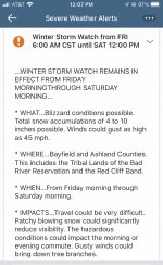
…WINTER STORM WARNING REMAINS IN EFFECT FROM 9 AM FRIDAY TO NOON
CST SATURDAY…
* WHAT…Heavy snow expected. Total snow accumulations between 8 and
12 inches expected. Winds could gust up to 40 mph and create
significant blowing and drifting snow.
* WHERE…Langlade, Florence, Forest, Northern Marinette County,
Northern Oconto County, Southern Marinette County, and Southern
Oconto County Counties.
* WHEN…From 9 AM Friday to noon CST Saturday.
* IMPACTS…Travel could be very difficult to impossible. Widespread
blowing snow could significantly reduce visibility, and result in
near-blizzard conditions Friday night. The hazardous conditions
will impact the Friday evening commute. Gusty winds could bring
down tree branches, and cause power outages.
Looking at the models-
The European has us for about 7-8″. I can’t show that one because of copyright stuff.
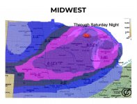
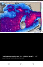
This is the RAP, one of the short term models showing us on the line between 6-8″ and 8-10″.

This is the NAM model showing us getting 6-8″.

The GFS model is the outlier showing us only getting 1-2″

The TV weather guys pointed out that the winds would be very favorable for lake effect enhancement. If it works out we could see a couple of more inches than the models are showing.
The NWS also pointed out that the beginning of the storm would be fairly dense snow, but as the storm progresses it will get colder and fluffier snow. That fluffier snow would tend to blow around more. Between that and the high winds they have the ‘Near blizzard conditions’ wording in their warning.
We will know a lot more as the day progresses. I will keep you up to date.
Have a good Friday and thank you for visiting!
RJB.


