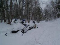
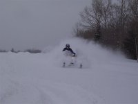
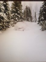
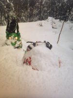
I know you have ended your seasonal forecasts, but is there anyway you could keep us posted on this potential storm for next weekend? When was that monster spring April storm that dumped like 4 feet? Wasn't it 2006 or 2007? I remember the pics of you, Al, and Matt all buried on the community power line by Vansville bar, it was epic!!
You are using an out of date browser. It may not display this or other websites correctly.
You should upgrade or use an alternative browser.
You should upgrade or use an alternative browser.
Pretty please?
- Thread starter offpiste
- Start date
Perhaps we can find a compromise. I am not going to do regular updates to the forecasts, but will give a brief synopsis with this system as it stands now in this thread and will make adjustments as we go through the week.
As things stand right now, 1 foot plus snows would fall from northeast MN into most of the UP and northern 1/4 of WI. Starting early Friday and continuing into the weekend, it would be a slow moving system, with steady snows Fri-Sun.
-John
As things stand right now, 1 foot plus snows would fall from northeast MN into most of the UP and northern 1/4 of WI. Starting early Friday and continuing into the weekend, it would be a slow moving system, with steady snows Fri-Sun.
-John
So not has changed. but still enough uncertainty in things that it would not be wise to be getting too detailed. Main changes are for a slower start and later ending. Looks like things will get going as we go through the day on Friday and continue into Monday.
-John
-John
fusionrider600
Member
Thanks for the update. Please keep them coming.
Did someone say monster storm in the journal?Fingers crossed, it it happens, awesome, if it doesn't, thats ok too. Lol.
I am sure the U.P. populous are crossing their fingers this does not occur, a 12 inch heavy wet snow to shovel, drive and wait through.
When I checked into the Super 8 11 days ago, the man checking me in said he was just happy to see the sun for a change. He said. haven't you had enough snowmobiling yet? There were only two trailers in the lot.
Bear
mezz
Well-known member
I know you have ended your seasonal forecasts, but is there anyway you could keep us posted on this potential storm for next weekend? When was that monster spring April storm that dumped like 4 feet? Wasn't it 2006 or 2007? I remember the pics of you, Al, and Matt all buried on the community power line by Vansville bar, it was epic!!
April 7, 2007, It was indeed EPIC! We literally went from zero snow to over 60" in little over 3 days.

 For this to happen now, wouldn't really be that epic because we are still sitting on 24 to 30". This has to be the longest I've seen the snow hang on like this. Typically this time of year, if you want to ride, there is usually some trailering involved to get to good snow, right now, you can damn near ride right from your back door still. If we get hit, oh well, right now, what I am looking forward to is it finally disappearing. Too many projects that need to get done & summer is too short as it is.-Mezz
mezz
Well-known member
Haha!! Good one & Dooley noted. Duh, "right now" and "still", do I get credit for realizing my grammatical blunder? My apologies


Last edited:
So here is the latest.
There are still some differences in the models and still enough time for changes, but the latest trend has been to shift the band of heaviest snow south some. Areas currently indicated to see the heaviest totals would be north central and northeast WI, the eastern 2/3rds of the UP and far northern lower MI. Totals in excess of 12" look to be a very high likelihood, with the potential for double that in spots. A general 8-12" would fall across most of SD, the southern 1/2 of MN into most of the rest of WI, with the exceptions of the far south, which would see just a few inches. The western 1/3rd of the UP would also be included in the 8-12" totals range. Within the area of 8-12" just mentioned, some 12"+ totals would also be possible.
An important feature to this system will be it's slow movement. We are all accustomed to a storm lasting 12-18 hours in most cases. This one will spread it's first snows into the upper Midwest as early as the wee morning hours of Friday, with things really getting going in the S. UP and N. WI on Friday. Saturday may see a bit of a lull for most areas, with heavy snows in NE WI and south central MN and then another round of heavy snow looks to impact most of WI, the UP and northern lower MI Sunday, with LES to add a few inches to the UP snow belts Monday.
-John
Thanks John, should I take Monday off from work? Lol
In all seriousness. Anyone wanting to play in snow in the western UP would be best served to wait until later Sunday into Monday and Tuesday. For those in northern WI and the eastern UP Sat, Sun look to be the best.
-John
Sled Solutions
Member
You rock John, thank you!


